- |
Modes: » Live Mapping - Create your maps using the GPS
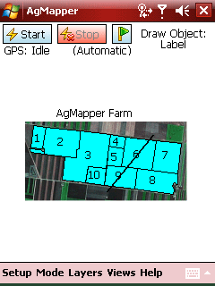
 » Draw - Manually draw lines, polygons & labels » Draw - Manually draw lines, polygons & labels
- Attributes: View, create, edit and delete
- Properties: Get areas and lengths of existing shapes
- Measure: Areas and lengths using a temporary line
» Compass - Electronic compass mode
» GoTo - Navigate your way back to important locations
|
- |
All mapping information is stored in the open file formats .SHP or .KML files.
Transfer of mapping data from and to AgMapper is simple. |
- |
Custom designed Layer & Layer Group manager. |
- |
Custom view manager, select multiple layers with one screen tap! |
- |
nth Precision Position Offsetting (left & right) |
- |
Metric or U.S. systems for measurements |
- |
No limit to the number of map or way point layers loaded |
- |
Most of the worlds datum and grid systems supported |
- |
Loads and saves to .KML (Google Earth) & .SHP. Convert both ways. |